


Stepping behind the wheel of your boat in Stuart and setting your course out into the beautiful water fields of the Treasure Coast is the ultimate expression of freedom. Whether you are navigating the busy weekend channels of the St. Lucie River, dropping anchor at the local sandbar near Sewall’s Point, or plotting a deep offshore run into the open Atlantic through the St. Lucie Inlet, keeping an eye on the sky is your most critical job as a captain. Our sub-tropical environment brings unique meteorological equations—intense midday heat indexes can instantly trigger rapid afternoon thunderstorms, and wind vectors can shift dramatically across the water within minutes.
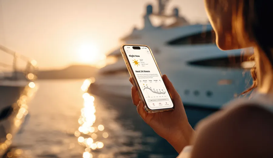
Relying entirely on a casual look at the clouds isn't enough to protect your crew. Equipping your smartphone or helm tablet with next-generation, high-purity marine weather tracking software is your primary line of defense against unexpected sub-tropical downpours and sudden open-water chops.
1. PredictWind: High-Resolution Marine Wind Models
When it comes to understanding exactly how wind and wave frequencies will impact your ride over the inlet bar or out in the open ocean, PredictWind is the industry standard.
- Compare Advanced Forecast Models: The app provides side-by-side comparisons of top global and regional weather models, including the high-resolution PWG/PWE models alongside ECMWF and GFS data. This gives you a highly accurate look at localized wind speed grids and wave directions.
- Smart Route Planning: The weather routing tool calculates the safest, most comfortable path based on your boat's specific cruising parameters, helping you avoid heavy, stacked cross-cutting displacement chop before you ever clear the no-wake zones.
2. RadarScope: Live NEXRAD Doppler Imagery for Fast Storms
Sub-tropical summer heat loops consistently spawn localized, fast-moving downpours that can drop visibility to near-zero within a matter of minutes. For tracking these specific, dangerous cells, RadarScope is the choice of professional pilots and mariners.
- Access Raw NEXRAD Level 3 Data: Unlike consumer weather apps that smooth out radar images, RadarScope delivers true, unedited reflectivity and velocity data straight from NOAA radar stations, allowing you to see exact storm cell borders and heavy rain bands.
- Track Lightning Trajectories: The application maps live lightning strikes in real-time, showing you the exact direction a squall is tracking so you have plenty of time to head back to the harbor or tuck behind a sheltered shoreline.
3. Buoyweather: Direct Spot Forecasts and Real-Time Buoy Data
The most accurate snapshot of current conditions doesn't come from a computer model generated miles away—it comes from live ocean telemetry assets floating out in the elements. Buoyweather simplifies this data instantly.
- Virtual Marine Forecast Points: By tapping anywhere on the digital chart, Buoyweather generates a precise, point-specific marine forecast for that exact square of open water, drawing directly from the global National Data Buoy Center network.
- Live Ocean Conditions: Get instant, live readouts of current wind gusts, actual wave periods, and barometric pressure drops straight from nearby offshore buoys, helping you pinpoint productive current boundaries for offshore angling.
4. Weather Underground: Highly Localized Weather Networks
When severe weather developing across the coast or the Everglades poses an immediate risk to small craft, you need real-time data from the closest land masses possible. Weather Underground specializes in hyper-local tracking.
- Crowdsourced Weather Stations: This platform connects to thousands of personal weather stations scattered across Martin County, giving you real-time wind speeds and heat index numbers from the specific waterfront neighborhood right next to your current channel.
- NWS Marine Alert Integration: Ensure your push notifications are active to receive immediate National Weather Service small craft advisories, storm watches, and coastal warnings specific to the Treasure Coast coastal zones long before the wind picks up.
5. Tides Near Me: High-Accuracy Coastal Tide Charts
Tidal movements across the St. Lucie Inlet and Indian River Lagoon shape everything from your access to shallow snook flats to the current conditions at popular anchorages. Tides Near Me presents this data quickly without a cluttered interface.
- Map Tidal Cycles Instantly: The application provides clean, graphical tide tables showing high and low tide charts, exact moon phases, and current water flow direction across localized cuts and flats.
- Prevent Sandbar Groundings: Tracking your local tide curves ensures you never get caught out by a dropping low-tide cycle while anchoring near shallow margins, protecting your fiberglass hull strakes and lower units from scraping the bottom.
Frequently Asked Questions
What is the legal speed restriction for operating a watercraft after dark in Florida waters? Unlike jurisdictions with blanket numeric nighttime speed caps, Florida maritime law mandates that all vessels maintain a "safe speed" at night based on prevailing visibility, weather, and traffic conditions. However, operators must strictly adhere to localized, posted "Slow Speed, Minimum Wake" restrictions, which legally require the hull to ride fully off plane and completely settled in the water column with a minimal wake profile.
Why is running the engine bilge blower mandatory before launching or starting an inboard vessel? Gasoline fuel vapors are heavier than atmospheric air and naturally accumulate in the lowest quadrants of a sealed engine bay or bilge compartment. Safety regulations dictate that power-operated exhaust blowers must be activated for a minimum of four continuous minutes prior to starting an inboard or sterndrive engine. This process evacuates any trapped combustible vapors, preventing a catastrophic static-spark explosion inside the hull machinery space.
Sourcing Authorized Marine Assets & Technical Upkeep
Safeguarding your vessel through variable seasonal conditions requires outfitting your platform with components and mechanical structures calibrated to exact manufacturer tolerances.
- Thoroughly Inspected Brokerage Inventories: To evaluate rough-water hull geometries, test luxury layouts, or compare the tracking profiles of elite regional brands, explore our complete regional inventories of premium Used Boats.
- Advanced Transom Repower Operations: If your existing power plant exhibits low-end throttle lag or lacks modern digital networks near the courtesy docks, outfitting your transom through our specialized Repower Mercury or Repower Yamaha hubs installs advanced control systems for absolute handling precision.
- Certified Multi-Point Systems Maintenance: From testing low-voltage battery capacities under load to replacing raw-water pump impellers or diagnosing hydraulic steering binding, trust our factory-trained technicians at the Central Marine Stuart Service Center department for detailed cosmetic detailing and preventative mechanical checks. For do-it-yourself maintenance, our Parts Center supplies factory-direct filters, zinc anodes, and marine accessories.
Fleet Allocation and Financial Coordination
What structural consumer credit frameworks exist for premium vessel procurement? Our internal Financing office constructs customized consumer portfolios, allowing buyers to seamlessly bundle their high-performance hull selection, reliable outboards, technical navigation electronics, and comprehensive Marine Insurance protections into a single structured loan.
Can I leverage my current boat's equity to transition to a modern rough-water platform? Yes. We facilitate transparent, market-accurate asset evaluations to eliminate personal listing delays. To liquidate your old hull and apply its equity directly toward an upgrade, submit your vessel's technical specifications to our Sell / Trade department.
How do I track upcoming dealer events or connect with Central Marine Stuart? To learn about our 39-year legacy serving Treasure Coast mariners since 1987, visit our About Us page. You can monitor our active schedule of safe-boating seminars, captain safety workshops, and regional boat shows on our Events page, track continuous technical maintenance guides on our Blog section, see verified customer feedback on our Reviews directory, or connect directly with our specialized team members via our Staff index. To review extended service coverages, check our Extended Service Contracts checklist, and find current promotions on our Specials page. Experience these performance traits firsthand and evaluate various configurations across real-world water conditions by connecting directly through our main Contact Us portal.